As the eel project has been wrapping up throughout the fall, we have had a couple finally field days below Chaudiere Falls dam complex completing bathymetry work. Bathymetry is the study of underwater topography, in other words determining how deep it is throughout the lake or river. For example, below is a bathymetric map of Lake Superior, with different colours represent different depths throughout the lake.
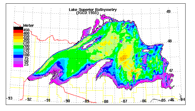
Bathymetry of the Chaudiere Falls complex is important by determining the depth of the area, this can help researchers better understand the habitat of the area for not only eels but also other important species such as lake sturgeon. In addition, knowing the relief of the area, we can use this data to help place our receivers for the acoustic telemetry study for 2015.
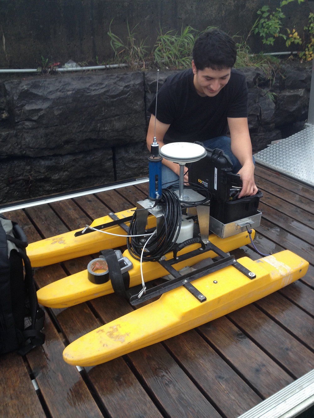
To help complete this work, we partnered with Dr. Colin Rennie from the University of Ottawa. Dr. Rennie is a civil engineering professor and the head of the Civil Engineering Hydraulics Laboratory at the University of Ottawa which studies river dynamics and environmental hydraulics. Sean Ferguson, a first year Masters student of Dr. Rennie’s, came out on the boat to run the aDcp unit. This data will be useful to Sean in the pursuit of his Masters, as his thesis focuses on morphology of rivers and aquatic habitats. Sean is specifically focusing on rivers that contain bedrock and the relationship between bedrock and aquatic habitat availability in fish species. For more information on Dr. Rennie’s projects, please visit his website.
Sean and I spent 3 days on the boat collecting data below Chaudiere Falls driving around collecting data using the aDcp unit shown below.


It was a chilly couple days in the field, but we finished all the bathymetric work last week! It was a great couple extra days in the field and the data acquired will be very helpful for future eel work in the Ottawa River.
CWF-FCF
Our mission is to conserve and inspire the conservation of Canada’s wildlife and habitats for the use and enjoyment of all.

1 comment
Just wondering what the results are? Do you think the falls have moved much in the 10K years of their existence?